California's Highway 1 is one of the great drives, and one decision made before starting determines how good it is: which direction you go.
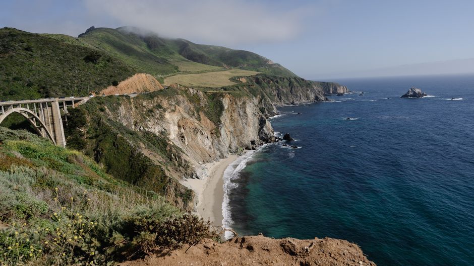
Drive southbound
You are on the ocean side of the road.
Which means the viewpoints and pull-offs are on your right, and you can enter and leave them without crossing oncoming traffic on a blind cliff bend.
Northbound puts the cliff between you and the view, and every stop involves a left turn across the lane with the drop on the far side.
This is not a preference. It is the single most useful thing to know about the route.
The closure problem
Landslides have closed sections of Highway 1 through Big Sur for months and occasionally years.
Closures are announced at short notice, and the inland detour via Highway 101 is long and misses the point entirely.
Check the California transportation department's current status before committing, and again a day or two before you drive it. This is the most frequently outdated information about the route.
How long it takes
Seven to ten days from San Francisco to San Diego to do it properly.
Four days is the absolute minimum and involves driving past most of it.
The road is slow by design — winding, with a low speed limit through Big Sur, and frequent stops. Daily distances are far shorter than the map implies, and this is correct rather than a failure.
The stops, north to south
Half Moon Bay and Pescadero, just south of San Francisco.
Santa Cruz, with the boardwalk.
Monterey and Point Lobos — the aquarium is excellent, and Point Lobos state reserve is the better of the two for a walk. 17-Mile Drive is a toll road through Pebble Beach.
Big Sur — Bixby Bridge, McWay Falls dropping onto a beach, Pfeiffer Beach with its purple sand and rock arch, and Julia Pfeiffer Burns state park.
Piedras Blancas — an elephant seal colony visible from a boardwalk, free, and one of the best wildlife stops on any American road.
Hearst Castle at San Simeon — tours booked ahead.
Morro Bay, with its volcanic plug in the harbour.
Santa Barbara, Malibu, and into Los Angeles.
Big Sur practicalities
Almost no fuel or services for about 100 km, and what exists is expensive.
Fill up in Carmel or Cambria before entering.
No mobile signal for long stretches — download maps offline.
Accommodation is scarce and expensive and books months ahead. Camping requires reservations.
Fog is common in summer mornings and can hide the entire coast until midday.
Season
| Period | Conditions |
|---|---|
| Sep–Oct | Best — clear, warm, fewer people |
| Apr–Jun | Good; morning fog common |
| Jul–Aug | Busiest, fog, accommodation scarce |
| Nov–Mar | Rain, closure risk, whale migration |
Grey whale migration is visible from the shore roughly December to April.